Applications
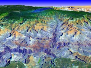
Geologic Mapping
asterweb.jpl.nasa.gov/applications
ASTER images are often used for geologic
mapping.
Not only does this image show different strata in different
colors, but it also show the topography of the region
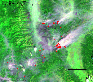
Forest Fires
http://modis-fire.gsfc.nasa.gov/
One of MODIS's main uses is to help monitor forest
fires.
This MODIS image shows forest fires in Idaho during the summer
of 2002.The red area on the image show are that were burining
during image aquisition while the gray area depict burn scares.
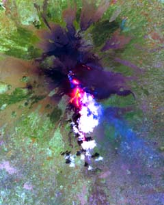
Volcano Monitoring
asterweb.jpl.nasa.gov/applications
An ASTER imagae of a volcanic eruption over Mt. Etna
Italy.
Not only can ASTER detect the thermal properites of lava flows it
also has the capability of detecting gas emmisions from the volcano.
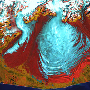
Sea Ice & Glaciers
http://landsat.gsfc.nasa.gov/earthasart/malaspina.html\
A Landsat 7 image of the largest glacier in Alaska.
Malaspina Glacier is located west of Yalcutat
Bay and is
3,880 km squared. Movement of glaciers and sea ice is often
studied using remote sensing.
Urban Growth
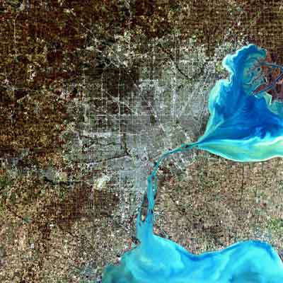
http://landsat7.usgs.gov/gallery/image
A Landsat 7 image of Detroit, Michigan.
Remote Sensing is often used to study changes
to urban area along with the effects of that growth.
Vegetation Mapping
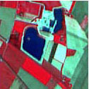
http://www.spotimage.fr/home/
This SPOT image is mapping diifernt type of agricultural
area.
Remote sensing is often used to detect changes in vegetaion
especially due to deforestation