Imaging Software

The development of technology necessary to detect extremely small space debris to further develop spacecraft warning systems and debris avoidance requires optimal imaging conditions to detect differences between background stars and the very small space debris. Small space debris is the most dangerous because it is so difficult to detect and thus avoid or remove. Developing this software is necessary given how the cascade process has resulted in an expansive cloud of small debris that is nearly undetectable with current spacecraft software.
Ground-based telescopes monitor movement frequency of Resident Space Objects (RSOs) in Earth’s orbit. Space debris surveillance can be utilized for “orbit prediction” and “conjunction assessment” in order to track surrounding RSOs that threaten any current or future space mission
s.17 In tracking these objects, scientists are already aware that moving objects leave streaks in the optical images captured by a telescope. Scientists inspect the images for these streaks and can interpret statistics on density of space debris in Earth’s orbit.18


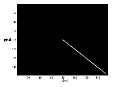
Figure of simulated streak
Figure of simulated streak.
19

The simulations of optical images of space debris can help to develop a “space-object detection algorithm” to assist spacecraft entering space with foundational awareness of surrounding objects. Those spacecraft with attached viewing or “optical” mechanisms can supplement the foundational understanding of the surrounding objects until there is a coherent map for scientists to better predict where the threat debris poses on spacecraft will be greatest and how the debris moves to better plan ADR missions. A well-rounded simulation method focuses on “streaks” caused by the movement of debris and its speed and “saturated star-background” caused by bright stars in the background of spac
e.19 This way, the technology can differentiate between streaks and saturated star-background and realize depth of field based on these indicators.
The main methods of simulation use orbit information, point-angle feature, and edge feature to determine X, Y, and Z coordinates in relation to the sensor on a satellite, then judge the object’s position in spac
e.20 A proposed detection sensor for satellites is a camera attached to a satellite. The spacecraft can maneuver in such a way that the camera is directed at a fixed point in space, and when debris streaks across the camera image, the spacecraft maneuvers in such a way that it tracks the motion of debris with its sensor. Then, when the debris leave the spacecraft’s field of view, it would stop rotating.21 This would allow for space tracking of debris without prior knowledge of where the debris is located, then the imaging software and internal directional tracking of the spacecraft can determine where the debris is by frequency, length, and width of streaks.