Formation
Uptill now we
were discussing about how is the updrift devoloped. Along with
the updrift the other necessary components needed for the
formation of a tornado will be discussed now. For this we
need to learn about few terms commonly used to describe the generation
of tornado and its structure.
Cold front:
When
an cold
(and normally dry) air mass advances into a warmer air-zone and
displaces it,
the transition zone is called the ‘cold front’. In a weather map a
cold-front
is shown by a line marked with triangles.
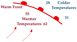
Warm front:
A warm-front is
where warm air is overtaking or
displacing cold air. A warm-front is shown by a line marked with
semi-circles,
in a weather map.

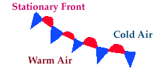
Stationary
front:
It is the zone
where cold air meets warm air, but
neither of them displaces the other. The symbol for this is practically
a combination of previous two symbols.

Occluded
front:
It is the
transition region where cold air overtakes
the warm air and lifts it off the ground.
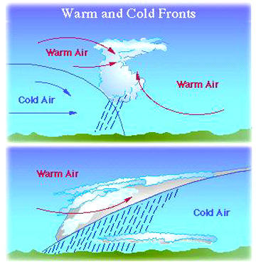
Warm air meets cold air:

when cold air and
warm air meet, the
moist warm air,
being lighter,
rises above the
cold air.The next
course of
incidents depent
on the
temperatures of
the air flows as
well as on their
humidities.
As the rising
warm air is
normally moist, it results in clouds. The situation
normally becomes fevorable for precipitation.
So, at a cold front, where cold air overtakes warm air, the warm air
rises rapidly and gets cooled. This can create thunder stormss.
In a certain situation cold air is supposed to be on the north and the
warm air to the south (see diagram). Then, atmospheric conditions may develop the associated vortices, in
such a way that the transition from cold to warm air takes place in a
very narrow area of low pressure. This
continues until a sudden jump in temperature occurs forming a
front.
In the diagram, the shaded portion around the low
pressure zone ( marked L), mrsciguy.com/documents/lab6-6storms.ppt
represents the formation of bands of
spiral cloud.


