The Setting of Gambell
The closeup map of the setting
of Gambell, below, shows a steady drop in water depth going offshore from the
beach, reaching a little less than 70 fathoms ( ~ 200 feet) within 50 km of the
beach. The floor of the continental
shelf, as shown on the middle map, covers more than half of the

Map of the west end of Saint
Lawrence Island showing Gambell, which faces west. All elevations, depth curves and soundings are
in feet. The blue shaded area at sea is
where the depth is equal to or less than 60 feet (just a little less than 20
meters.) The black, dashed line to the
northwest of the island is the International Date Line. From Defense Mapping Agency, 1961.
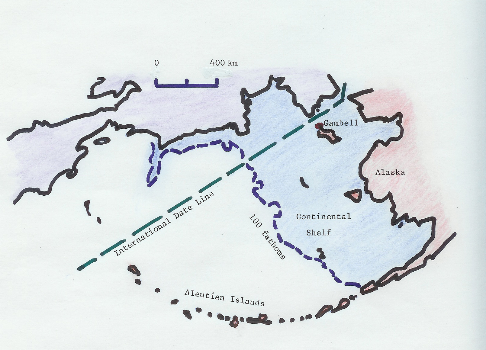
Map of the Bering Sea showing
the location of the
Cross section along the International
Date Line from the Aleutian Island Chain up to Gambell, Saint Lawrence Island. About 1,000 kilometers of deep water is
followed by approximately 600 kilometers of shallow water, in which shallow
water equations would apply. Chart
adapted from data of USGS, 2007.
The cross section of the Bering
Sea bathymetry, running from the Aleutians up to Gambell, shows that there are
two very distinct underwater regimes between the Aleutians and the northern
High seas in the northern
Areas of open water, or
polynyas, are known to form along favored stretches of the