What is a Glacier?
The U.S. Geological Survey defines a glacier as a “large, perennial accumulation of crystalline ice, snow, rock, sediment, and often liquid water that originates on land and moves down slope under the influence of its own weight and gravity”. First described in Icelandic literature in the 11th century, glacial ice currently envelopes around 10% of the land on Earth, or about 15,000,000 square kilometers, and has covered up to 32% during past ice ages. In the United States alone, glaciers cover over 75,000 square kilometers of land area. Glaciers also store three quarters of the earth’s fresh water supply, with glacial melt serving as a significant water source for many rivers. They are also very important to topography, creating many of the landscape features that we see around us, eroding and depositing material to create features such as valleys, cirques, and kettle lakes.
 |
|
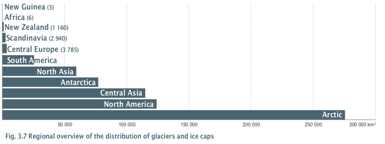
Source:http://www.grid.unep.ch/glaciers/pdfs/3.pdf
|