The Height of the Tropopause
And the Meandering Jet Stream
What
is the tropopause, anyway?
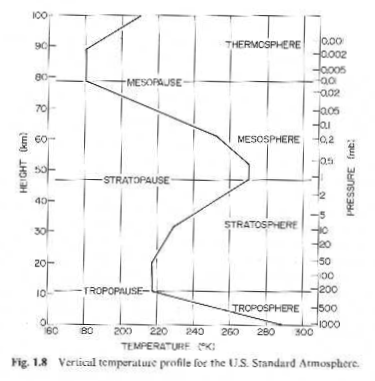
This vertical temperature profile (from Wallace and Hobbs, 1977) shows several characteristics we want to remember . . .
Ø The
tropopause is the upper boundary of the troposphere, the well-mixed layer where
the weather is, where temperature falls off with height.
Ø It
is the coolest point in the troposphere.
Ø It
is adjacent to the lower stratosphere, the stable layer where temperature
generally rises with height.
Let’s bring it
within reach, low and close to home:
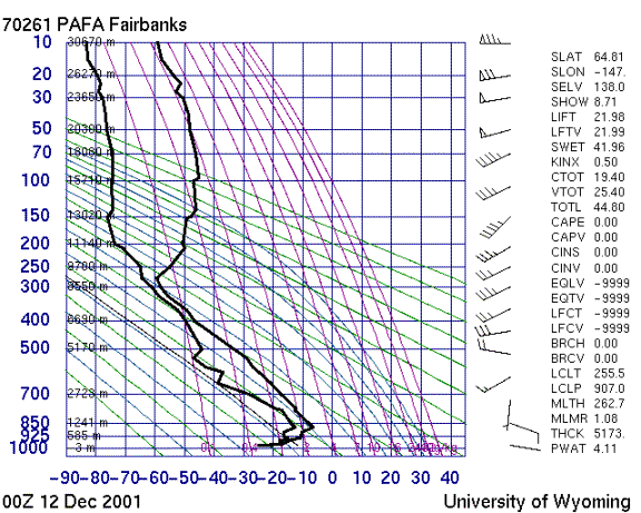
http://weather.uwyo.edu/upperair/sounding.html
This recent sounding shows the tropopause about 9 km above Fairbanks. The black line on the right departs from its nearly linear lapse rate at that level, having reached its coldest extreme. Click on this chart to view other soundings.
Too cold? Let’s visit Trinidad, where the trope is soaring up at around 16 km.
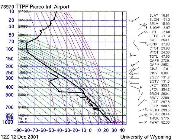
http://weather.uwyo.edu/upperair/sounding.html

This web page prepared by Cliff
Cole for Dr. Newman’s Geophysical Fluid Dynamics Course: http://ffden-2.phys.uaf.edu/