What
is Remote Sensing?
| Source: http://rst.gsfc.nasa.gov/ |
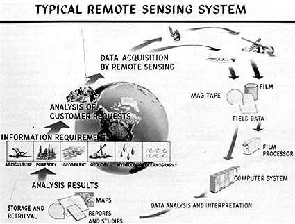
- Remote
sensing is the science of acquiring, processing, and interpreting
images that record the interaction between electromagnetic energy
and matter.
- Aerial
photographs were the first remotely sensed images and remain the most
widely used today for interpretation of landforms.
| |
| False-color,
IR aerial photograph- scale
1:8,000 |
Source:
http://rst.gsfc.nasa.gov/ |
- Images obtained from orbitting satellites were first
introduced in 1960. The polar-orbiting TIROS 1 satellite was launched
by the National Oceanic and Atmospheric Administration (NOAA) to monitor
the property and patterns of clouds.
 |
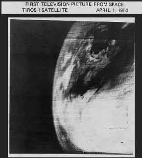 |
TIROS-1
SATELLITE 1960 |
FIRST
TIROS-1 IMAGE |
Source:
www.space.com/news/spacehistory/tiros_anniversary_000330.html
|
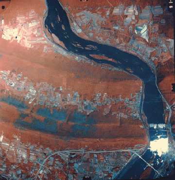
- Satellite images acquired 40 years later have much
greater resolution and digital manipulation capabilities.
|