Application
Normally, we want to do more than just look at or make
appealing images. By using sensor data, we can compare and
model some processes and features that would be fairly hard
using only what we could see with out eyes. For instance, if
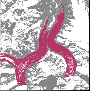
we wanted to take account of the total amount of glacial ice
in an area, ignoring everything else, creating a composite
image of only two data types is idea - ice, and not ice. We
might also want to take stock of different materials that
would otherwise be very similar visually, for this there is
the false image.
This image is created by assigning particular spectral
patterns to glaciers which in turn highlights the glacier ice,
snow, and rock.

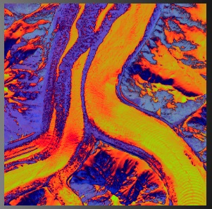
This image is a false color that attempts to differentiate
both the snow and ice with the surrounding cold stone, much
like the above. However this image ALSO makes use of infrared
comparison to separate the snow from older snow and dirty
glacier ice debris from the glacier proper.

In this image, we use infrared and near-infrared wavelengths
to replace green and blue (and some minor visual editing) to
create a vividly contrasted image that lets us pick out
features that would be otherwise hard to distinguish. Darker
areas correspond to rock and debris-filled snow and ice that
reflect or transmit far less infrared than the relatively
bright fresh snow and ice. In the visual spectrum, snow and
ice are all but indistinguishable.
As we can see, the same image can be made to appear quiet
different depending on the wavelength of light that we are
using and how exactly we decide to make that new information
appear.