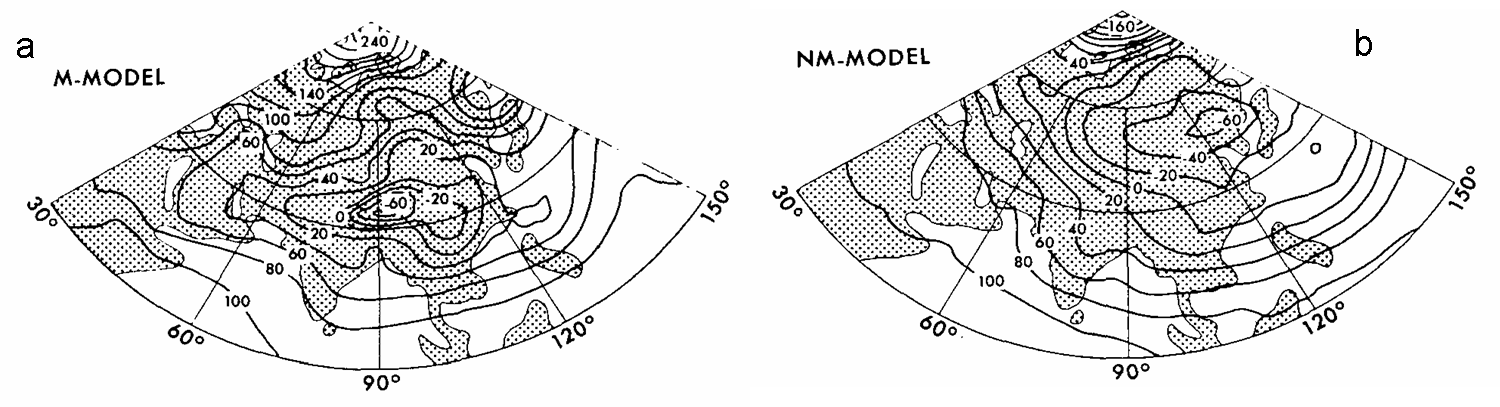
Hahn and Manabe (1975) showed that presence of mountain also influences the monsoon precipitation by influencing the location of continental low, high temperature and the precipitation belt using the General Circulation Model (GCM)
Spatial distribution of July mean geopotential height (m) at 100mb for simulation (a) with mountains (M-model) (b) without mountain (NM-model)
In GCM simulation with mountain, continental low is situated at 30 degree N with low pressure at highest point of Himalayas whereas continental low is shifted northeast and located at 50 degree N and 125 degree E in simulation without mountain
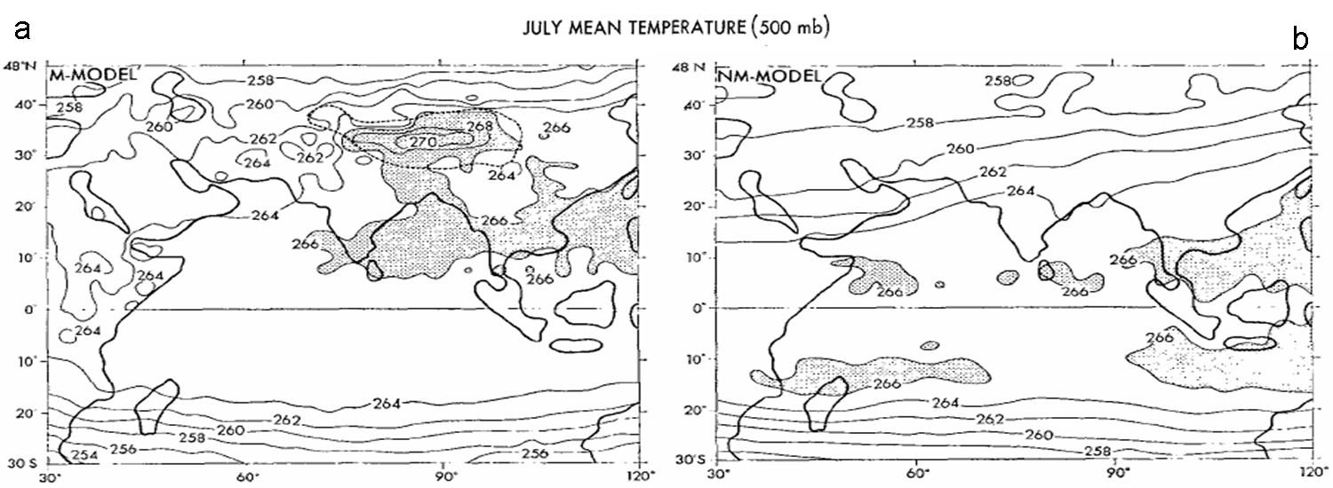
Spatial distribution of July mean 500mb temperature for simulation (a) with mountains (M-model) (b) without mountain (NM-model)
The maximum temperature at 500mb are located over Tibetan Plateau in simulation with mountain with secondary maximum temperature located at 15 degree N over Bay of Bengal whereas temperature is lower approximately by 10-12 degree C over Tibetan Plateau in simulation without mountain