So the tropopause lies low near the poles and rides high in the tropics. Below it, the troposphere is nearly isentropic—that is, it is nearly uniform (ignoring water’s effect and radiative forcing; See Bohren p.164) in potential temperature, being thoroughly mixed. Above it begins the stratosphere, where warmer layers are stacked upon colder ones in a very stable regime. There is little rapid mixing there. Or is there?
But what’s going on here?
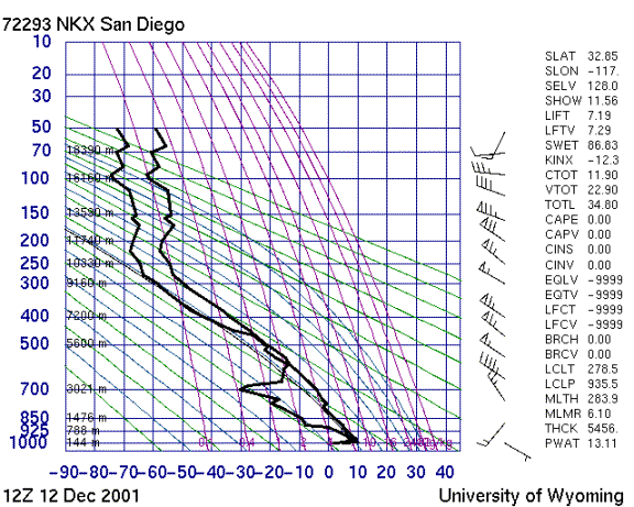
http://weather.uwyo.edu/upperair/sounding.html
Is that the tropopause at around 11 km? Or is it up above 16 km? Well, San Diego wasn’t picked for its air quality. It seems the tropopause is a bit folded there at the time. Note the break in the tropopause heights on the figures below (thick black line).
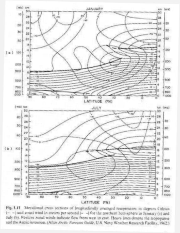
These are cross sections of the atmosphere, cut
along a meridian from the north pole to the equator (thanks again to Wallace and Hobbs, 1977). From these charts we might have guessed that
a discontinuity or a folding in the tropopause might lie between 30° and 40° north latitude. But why is
this strange feature in San Diego today?