Page 4
GPS Applications for Land Surveying
Construction companies are employing
GPS surveyors on large projects as an efficient way to check grades and
keep production moving.
Land surveyors are using GPS as a way to perform study and design work
in less time.
In land surveying work we make measurements from previously surveyed
reference points. Using GPS technology to perform land surveying
work is made easy using a method referred to as differential GPS.
Differential GPS Surveying
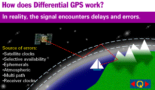
Differential GPS makes use of two receivers working together. One
receiver is stationary and set up on your reference point. The
stationary receiver ties in all the satellite data and acts as a
reference for the other receiver. The other receiver is mobile
and free to range out and take position measurements. Since the
scale that GPS works in is so large the small distances on earth
between the two rovers are insignificant. If the two receivers
are a few hundred miles apart on earth the radio signals they receive
from the satellites travel through virtually the same sections of
atmosphere and will therefore have the same atmospheric interruption
errors.
The stationary GPS uses the known
point it is positioned at and works in reverse measuring the timing
errors by comparing the actual time the radio signals took, to what
time the radio signals should have taken over the given distance.
(Known Distance) /
(Known Velocity of Radio Signal) = Time without Error
The timing error correction factors are transmitted to the mobile
receiver eliminating virtually all errors from the system.
Trimble Website
Applying this survey technique has several advantages over other
surveying methods, ultimately in simple functioning for the users and
less survey time required. Instead of trying to survey around
structures with line of sight instruments the GPS radio signals travel
directly through them.
end of page 4
link to page 5 5

