Earth materials of interest in remote sensing applications

  • Fire and smoke
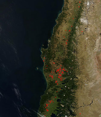
    • forest fire monitoring
    MODIS SATELLITE IMAGE DETECTING FOREST FILES IN CHILE
    Source:http://edcdaac.usgs.gov/modis


  • Water, ice, and snow
    • melting ice cap monitoring
    • snow and ice thickness in polar regions
    • water pollution
    • sediments in rivers
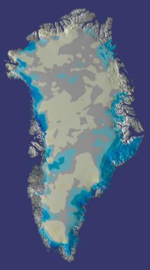
  • Recent measurements sponsored by NASA indicate that the amount of ice in Greenland is decreasing. Blues indicate areas where the loss of ice is greatest, and yellows indicate regions that are apparently thickening. Gray areas indicate no significant change in ice thickness.
    GREENLAND ICE SHEET
     
    Source: http://profhorn.aos.wisc.edu/wxwise/AckermanKnox/chap14/greenland_icesheet.html


  • Soil, minerals, and rocks
    • mineral mapping
    • terrain mapping


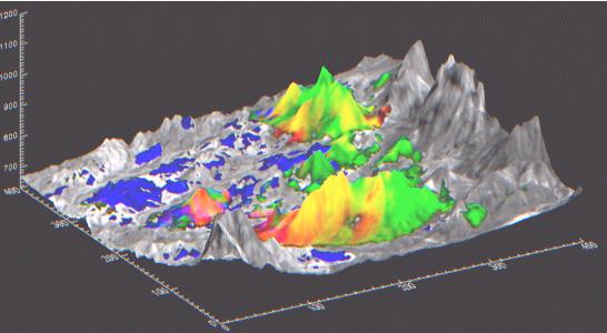
    Hyperspectral digital elevation model showing distribution of three minerals in the Oatman, Arizona mining district. This type of image allows geologists to analyze the geomorphology and mineralogy of a region.
    Source: www.atse.org.au/publications/symposium/proc_1998p6.htm


  • Vegetation
    • forest inventories
    • healthy vs. stressed vegetation
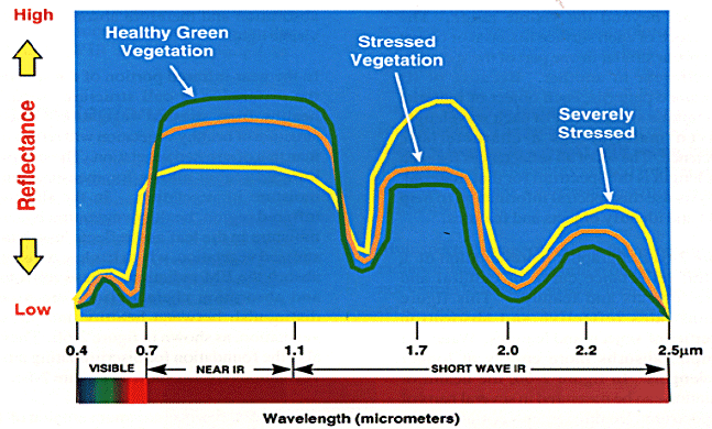
This graph illustrates the distinct spectral signatures reflected by healthy and unhealthy vegetation. Satellite sensors detect the different reflectances and records them as a digital color number.
Source: www.csc.noaa.gov/product/sccoasts/html/rsdetail.htm


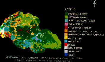
This image is an example of vegetation classification that was compiled on the basis of different spectral signatures of vegetation.
Source: http://ceos.cnes.fr:8100/cdrom-98/ceos1/casestud/geo