 |
 |
| GPS LINKS | |||||||||
........................................... |
|||||||||
| 11.04..2004 | |||||||||
|
Trilateration | ||||
 |
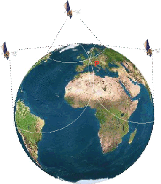
Trilateration refers to the geometric approach to measuring the distance from at least three satellites to determine a position on the surface of the Earth. Basically, the radio waves transmitted from the satellites radiate out in a spherical pattern at the speed of light. Since trigonometry requires three perfect measurements to determine a position in three-dimensional space, the position where these signals intersect with the surface of the Earth and bisect each other (position P on diagram) determines your position on the surface. In three-dimensional space this actually narrows it down to two positions, however one of those positions will generally be rejected mathematically by the receiver as being either too far out in space or moving at an impossible velocity. This is all assuming that the measurements are perfect, which they are not. Measurements based on only three satellites are not as accurate as using 4 or more satellites. This is mainly due to timing offsets from the non-syncronization of the clocks in GPS satellites and the receiver. |
||||
| > Continue | |||||